Our journey across the North Island led us to a place no one normally wants to explore, the deepest dread of Middle Earth: Mordor and its over-towering Mount Doom.
Mt Doom lies in the middle of the famous Tongariro Alpine Crossing, one of the most beautiful day-hikes in New Zealand. Unfortunately the track isn´t a loop, so if you want to do the crossing, you have to park at one side of the track and manage a transfer back to the other side which turned out to be quite expensive. So Marcell and I decided to do the crossing only halfway, and walk back the same way after ascending Mt Doom.
The road leading to Mount Doom, a perfectly cone-shaped volcano.
"One does not simply walk into Mordor", they say. But we didn´t care about what they say, and here we are. Two Austrian boys in their early twenties, ready to walk into Mordor.
We parked our car at the official Alpine Crossing car-park, grabbed some snacks and water-bottles and departed for what would turn out to be our most adventurous journey so far: a trip into Mordor´s heart.
The first part of the track was the easy part of our journey, flat and even, embellished with a neat little boardwalk.
After about two hours of hiking we reached the bottom of Mount Doom, which towered above us like the eye of Sauron the Dark Lord himself.
All the way back at the end of this valley (where you can see some green spots) lies the car-park where we came from.
The bottom of Mount Doom where we had a short break before ascending the mountain. This is the point where the official Tongariro Alpine Crossing Path splits from the semi-official path that leads up to the crater of Mount Doom. The official track, which does not include the climb up to the top of Mt Doom, takes about nine hours. So we reckoned it would take us about 7 or 8 hours to do our trip from the car-park to the top of Mt Doom and back.

Even from down here at the bottom one could clearly see how steep the ascent would get.
Soon the path vanished in these huge gravel fields, that were strewn with rocks of all sizes and we had to find our own way to the top. Unfortunately the gravel was extremely loose and with every step you took, you slipped back two. This made the climbing extremely exhausting and we had to take quite a few breaks until we finally reached the summit.
View down to the bottom of the mountain from where our tiring ascent had begun. Even from this point, only half way up the mountain, the panorama was breath-taking.
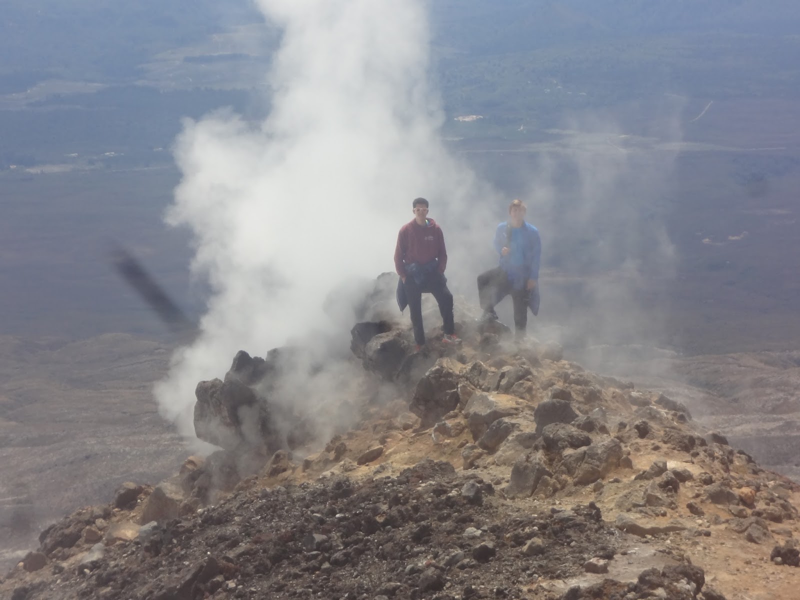
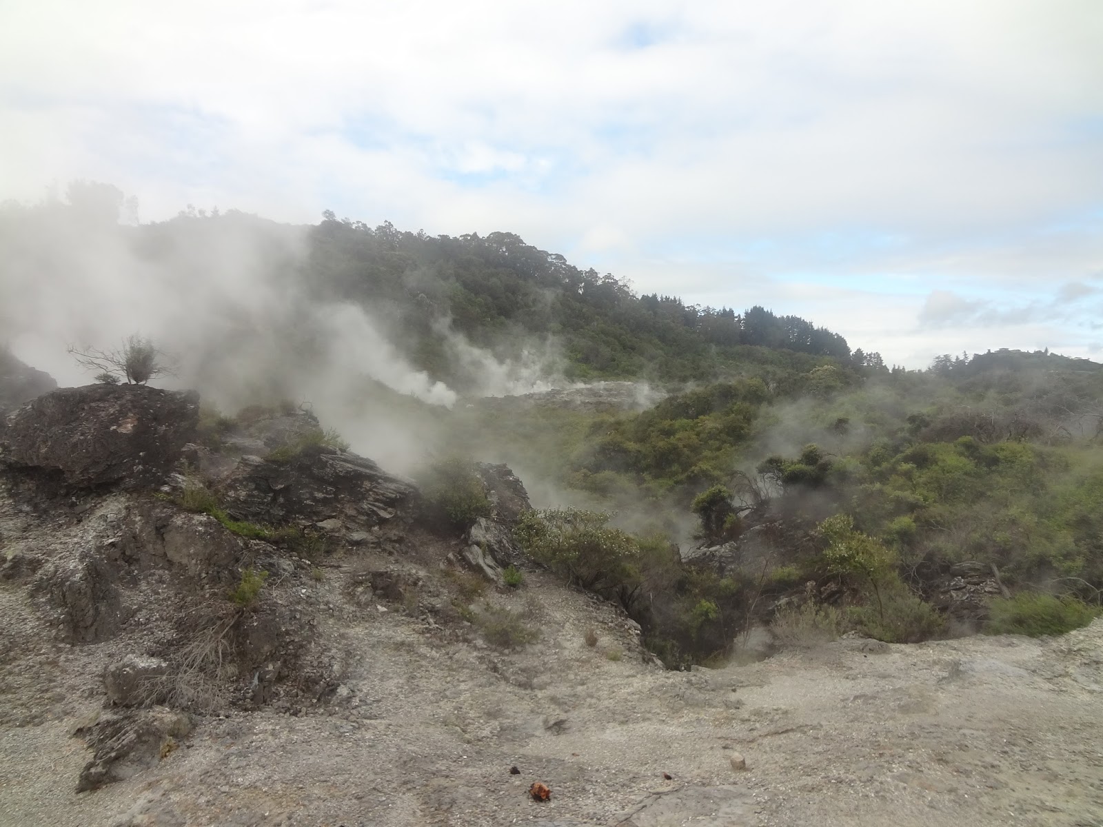
Finally, after another two-and-a-half-hours of climbing up the steep mountain-side, we reached the crest. Steam was evaporating out of the ground literally everywhere. What an epical welcome to the crater of Mount Doom, home to Middle Earth´s most vicious villain: The Dark Lord Sauron.
Standing on top of the crest, coated in steam and an incredibly beautiful panorama in the background - that´s most certainly worth the perilous and wearing climb!
View down onto the "base-camp". You can see the Alpine Crossing path coming in from the left, leading past Mount Doom to the small azure-blue lake in the background.
Steam was coming out of every single little hole in the ground and created a unique, almost epic atmosphere.
View down to the two "Emerald Lakes" on the other side of Mount Doom. Our original plan had been to descent to the lakes and find a way back to the car-park from there, but the climbing to the summit had taken longer than expected, so we decided to stay at the apex and just take some pictures of the lakes from the distance. Although the zoom of Marcell´s camera (and therefore the quality of the pictures) was not really satisfying, you can still guess the azure-blue color of the lakes, embedded in an otherwise extremely arid almost desert-like surrounding.
The top of Mt Doom - we made it!
Marcell and the mountain-rim along the snow-covered crater that emits shitloads of steam out of every hole in the ground.
Another group picture with a German guy we met on the way up. he´d had some issues with the slippery gravel "path", so Marcell and I had decided to play alpine guides for him and help him with the tricky way up.
Well, that´s what a picture on a volcano´s supposed to look like, eh?
We enjoyed the staggering ambiance for a while, took some 300 pictures and finally got ready for the way back down to the car-park. Blessedly for us the way down was way easier and quicker than its counterpart, the way up. We simply ran down one of the gravel paths and reached the bottom of the mountain within fifteen minutes or so.
A final look at Mt Doom towerin in the middle of the vast dry-lands of Mordor. So far, this has definitely been one of the most exciting and astonishing hikes for us. And now we know for sure how difficult it must have been for Sam and Frodo to climb up that damn mountain in order to destroy the ring.